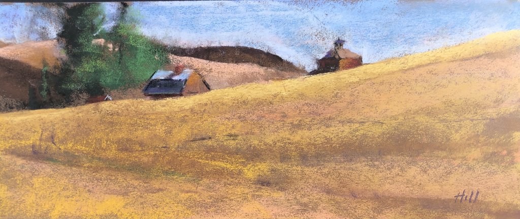
Golden Harvest near Pullman
The two distant barns at the upper edge of this huge wheat field caught my eye. Like so many vistas in The Palouse, only parts of buildings manifest themselves due to the incredible rolling landscape formed over millions of years by the soil that was completely scoured across most of western Montana, north Idaho and central Washington State from the ice dams that broke near Missoula . . . and was carried to the Columbia River as far as Portland, Oregon!
The prevailing winds blew all of that soil back to SE Washington, Idaho and NE Oregon over hundreds of thousands of years.
The Palouse was thus formed out of windblown sediment (pure topsoil), known as loess.
The deepest known sample of top soil in the world (measuring 155' depth) was taken just 8 miles from where this painting was done!!
It’s hard to imagine a flood so catastrophic that it wiped out everything in a swath hundreds of miles wide, with the velocity of nearly 10 times the speed of all the rivers in the world. And it happened at least 20 times over a few thousand years, as the ice regenerated to build new ice dams in the Missoula Valley of Montana. What a horrific sound it would have made made!
Today only a few passing cars and a slight breeze out there spoke in a mere whisper.
| Name | Golden Harvest near Pullman |
|---|---|
| Date Painted | Oct 03 2021 |
| Medium | Pastel |
| Dimensions | 5.5h x 13.25w in. unframed |
| Framed | No |